Opinion Column: Latent Risk of Forest Fires and the Need for Territorial Planning
In the current context of high temperatures, climate change, and human-induced alterations, among other factors, forest fires emerge as the most imminent risk affecting people, native ecosystems, and productive areas.
The characteristics that make some areas more prone to forest fires are the accumulation of biomass, that is, fuel, over several years. Another relevant aspect is the continuity of this fuel throughout the landscape
Currently, there are extensive, highly homogeneous landscapes with high biomass accumulation over many years, even decades. This, combined with existing climatic conditions such as heat waves and drought, makes them more vulnerable to the occurrence of fires
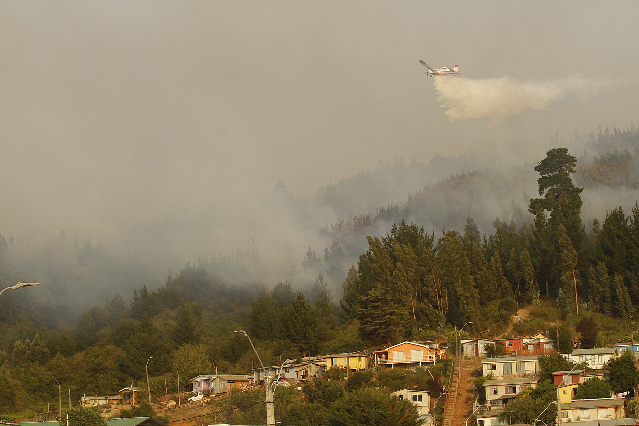
In this season, the risks of large-scale fires exist. Previously, research conducted in 2022 and 2023 by the UdeC Landscape Ecology Laboratory revealed that the communes of Santa Juana, Hualqui, Penco, and Tomé had high vulnerability. Unfortunately, these risks were confirmed with thousands of hectares at the mercy of the flames, whose severity claimed human lives, forests, and wildlife.
On the other hand, some tree species also have an impact on the spread of fires maritime pines existing in the Concepción area, is emblematic, as these are very long-lived trees, in some cases centuries old, that concentrate a large amount of biomass. The presence of these individuals results in greater fire propagation in the face of factors such as heat waves or winds exceeding 30 kilometers per hour.
In the same vein, the establishment of regular, in-line plantations also accelerates the spread of a fire. Research conducted in the United States has shown that in the case of plantations for forest restoration or recovery, it is necessary to break the landscape homogeneity by planting in a disorderly manner to create gaps, rather than a continuous fuel load at both the site and landscape scales.
In the past thirty years, the distance between forest plantations and residential areas in rural sectors or populated zones has shortened. While there is currently a discussion between academia and the public sector to advance the identification of risk areas, particularly at the interface between forest plantations and urban areas, among other aspects, there is a clear need for territorial planning that minimizes risks and maximizes ecosystem services for human well-being, not merely as indicative. There is a need to take a step forward to truly enhance territorial planning in order to reduce vulnerability to fires, advance sustainability, and strengthen the resilience of socio-ecological systems.
Dr. Cristian Echeverría Leal
Forestry Engineer, M.Phil., Ph.D., University of Cambridge, England, Academic Faculty of Forestry Sciences, UdeC, Director of the Campus Naturaleza Project, Universidad de Concepción


